3 Best Hiking Trails in Victoria, BC

Expert-recommended Top 3 Hiking Trails in Victoria, BC. All of our hiking trails actually undergo a rigorous 50-Point Inspection, which includes everything from checking reviews, ratings, reputation, history, complaints, satisfaction, trust and price - all to ensure overall excellence. You deserve only the best!

9+ YEARS ON TBR
CALL EMAIL

PKOLS (MOUNT DOUGLAS PARK)

4500 Cedar Hill Road,
Victoria, BC V8X 3S8 Directions

Since 1858

Specialty:

✓Hiking Trails ✓Walking Trails ✓Forest Trails ✓Summit Hiking ✓Scenic Viewpoints ✓Birdwatching ✓Wildlife Observation ✓Beach Access ✓Picnic Areas ✓Nature Appreciation

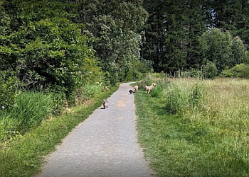
"PKOLS (Mount Douglas Park) features an extensive network of walking trails over 21 kilometres, providing sweeping views. The trails vary, with some winding through lush forests to the stunning summit viewpoint, while others descend to secluded sandy beaches. The park offers opportunities for engaging in social and physically active sports, fostering skill development and camaraderie. PKOLS (Mount Douglas Park) consistently has a clean environment and features charming forests with gravel pathways. Exploring this wooded terrain is made easy with its well-maintained trails. Visitors can enhance their experience by enjoying the beach playground or engaging in group games on the expansive field near the beach parking lot. PKOLS (Mount Douglas Park) offers a breathtaking 360-degree view of Victoria and its surroundings. You can take the 1,500m hike from the Churchill parking lot gate (42m above sea level) to the Summit parking lot (202m) for a 160 m gain. Or, go right to the Summit at the Geographic Marker for a gain of 225m.

2026 Highlights: PKOLS (Mount Douglas Park) visitors often hike trails to summit viewpoints for Mount Baker panoramas, enjoy beach picnics, or birdwatch in the woods."

Reviews | Play Video | Write a Review

Contact:

(250) 475-5522

Mon-Sun: Open 24 Hours

TBR® Inspection Report:

10+ YEARS ON TBR
CALL EMAIL

ELK/BEAVER LAKE REGIONAL PARK

5267 Patricia Bay Highway,
Victoria, BC V8Y 2T6 Directions

Since 1966

Specialty:

✓Hiking Trails ✓Walking Trails ✓Lakeside Trails ✓Forest Trails ✓Loop Trails ✓Walking ✓Running ✓Birdwatching ✓Nature Walks ✓Horseback Riding ✓Cycling ✓Fishing ✓Canoeing ✓Swimming Areas ✓Picnic Areas

"Elk/Beaver Lake Regional Park covers 1,072 acres and has interconnected lakes with four great, family-friendly beaches. The beaches offer picnic areas, 15 kilometres of walking trails, bird viewing, windsurfing, swimming, canoeing, and rowing. Elk/Beaver Lake Regional Park also has a restaurant during the summer season. The parks offer a secure and pleasant area for people to visit for picnics, hiking, and sports. Elk Lake and Beaver Lake are cultural centres for festivals, outdoor activities, and concerts throughout the year. These parks are mostly famous for their summer swimming spots. The area is the training ground for Canada's Olympic Rowing Team and hosts competitions for local schools each year. Elk/Beaver Lake Regional Park is home to many species of wildlife and plants. Elk/Beaver Lake Regional Park has a 10-kilometre loop trail.

2026 Highlights: Elk/Beaver Lake Regional Park features three small, named islands near the southern end of Beaver Lake: Kaitlin Island, Perry Island, and Isaac Island. They vary in size, with Kaitlin Island being the largest, reaching a maximum diameter of 190 metres."

Reviews | Play Video | Write a Review

Contact:

(250) 360-3000

Mon-Sun: Open 24 Hours

TBR® Inspection Report:

8+ YEARS ON TBR
CALL

MOUNT TOLMIE PARK

3492 Mayfair Drive, #3486,
Victoria, BC V8P 4P9 Directions

Since 1860

Specialty:

✓Hiking Trails ✓Walking Trails ✓Nature Trails ✓Summit Walks ✓Scenic Viewpoints ✓Birdwatching ✓Nature Appreciation ✓Sightseeing ✓Picnic Areas ✓Sunset Viewing

“Mount Tolmie Park features over 1,500 metres of hiking trails that wind through meadows and rocky slopes to the summit, offering visitors a peaceful outdoor experience. They can enjoy panoramic views of Saanich, Victoria, the Olympic Mountains, and Mount Baker from the summit’s open viewpoints. The park also provides scenic picnic areas, with tables situated in clearings along the trails, making it an ideal spot for relaxation and enjoying the surrounding landscape. Their natural environment combines open grassy areas, mature trees, and exposed rock formations. The summit and surrounding rocky outcrops feature mottled grey bedrock belonging to a group of rocks formed during the Jurassic Period, approximately 200 million years ago, adding geological significance to the park’s natural beauty.”

Reviews | Play Video | Write a Review

Contact:

TBR® Inspection Report:

We use cookies to improve your experience. By continuing, you agree to our Privacy Policy.